Map
Windy
Classic map
Take off
PPG
More
Parking
Landing
Winch
Meteo
School
Club
Company
Shop
Airport
Wiki
API
About Paragliding Mapa
CZ
EN
PL
DE
HU
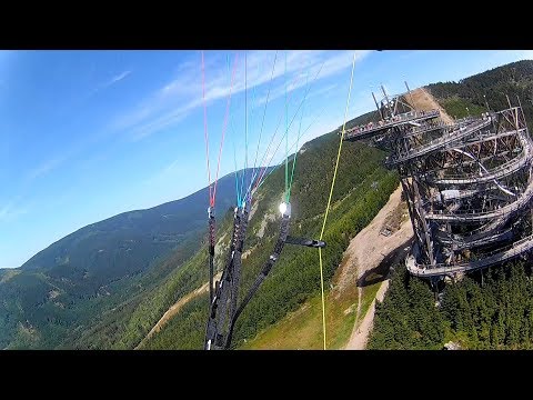
Take off - Dolní Morava
edit
270° - 330°
Wind direction
1068 MAMSL
Altitude
380 m
Superelevation
50.1498N 16.8281E
Show on map
Windy
Classic map
Cesium 3D
Google Maps
Mapy.cz
Tolerováno
Flying state
?
Taxes
Weather forecast
XCMeteo
Windy
Region
Česká republika - Pardubický kraj
Landing
Show on map
Classic map
Google Maps
Mapy.cz
Dolní Morava
At start
Restaurant, Water, Toilet, Accommodation
Access
lanovka
Webcam
https://www.dolnimorava.cz/web-kamery
Weather station
https://www.wunderground.com/dashboard/pws/IDOLNMOR4
Flights
xcontest.org
- last start:
yesterday
13:38
Photos
Video
Next photos and videos